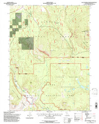
1995 Map of West Prospect Peak
USGS Topo · Published 1997About this map
West Prospect Peak stands as the prominent landmark on this 1990s survey, overlooking a volcanic landscape shaped by ancient and modern flows within Lassen Volcanic National Park. The terrain is marked by significant historical waypoints along the westward route, including Emigrant Ford and Emigrant Pass, while Twin Bridges crosses the upper reaches of Hat Creek. This area of the Lassen National Forest displays a mix of open meadows and lava fields, such as Anklin Meadows and Dersch Meadows. Evidence of the region’s geothermal history is clear in names like Hot Rock and Crescent Crater. The map also traces the high-elevation path of the Pacific Crest National Scenic Trail as it traverses Badger Mountain and Badger Flat, providing a detailed look at the trail network before the turn of the millennium.
Find a feature on this map
42 named features on this map. Tap any name to fly to it.
Don’t see what you’re looking for? This feature index may not catch every label — zoom into the map to look around manually.
Map Details
Editions of this 1995 West Prospect Peak Map
This is the sole edition of this map. No revisions or reprints were ever made.
Other maps of this area

1886 · Lassen Peak
USGS Topo · 1:250,000

1892 · Lassen Peak
USGS Topo · 1:250,000

1894 · Lassen Peak
USGS Topo · 1:250,000

1935 · Burney
USGS Topo · 1:96,000

1935 · Paynes Creek
USGS Topo · 1:96,000

1939 · Burney
USGS Topo · 1:125,000

1939 · Halls Flat
USGS Topo · 1:125,000

1941 · Mineral
USGS Topo · 1:125,000

1955 · Westwood
USGS Topo · 1:250,000

1956 · Lassen Peak
USGS Topo · 1:62,500