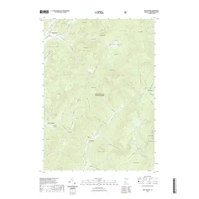
2021 Map of West Rupert
USGS Topo · Published 2021About this map
Green Mountain National Forest dominates this mountainous landscape in Bennington County, where narrow valleys dictate the pattern of human settlement. The village of West Rupert sits along White Cr near the foot of The Big Ridge, while smaller clusters like Beartown and West Sandgate occupy the hollows between prominent peaks. Genealogists will find a high density of burial sites preserved here, from the Sherman Homestead Cem deep in the hills to the West End Camdon Valley Cem near the western border.
Find a feature on this map
89 named features on this map. Tap any name to fly to it.
Don’t see what you’re looking for? This feature index may not catch every label — zoom into the map to look around manually.
Map Details
Editions of this 2021 West Rupert Map
This is the sole edition of this map. No revisions or reprints were ever made.
Other maps of this area

1893 · Fort Ann
USGS Topo · 1:62,500

1894 · Pawlet
USGS Topo · 1:62,500

1894 · Equinox
USGS Topo · 1:62,500

1895 · Cambridge
USGS Topo · 1:62,500

1895 · Fort Ann
USGS Topo · 1:62,500

1896 · Equinox
USGS Topo · 1:62,500

1897 · Pawlet
USGS Topo · 1:62,500

1898 · Cambridge
USGS Topo · 1:62,500

1898 · Fort Ann
USGS Topo · 1:62,500

1900 · Equinox
USGS Topo · 1:62,500