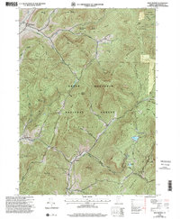
1995 Map of West Rupert
USGS Topo · Published 2000About this map
Green Mountain National Forest dominates this section of Bennington County, where the steep topography of the Taconic Range shapes the settlement patterns. Small communities like West Rupert and West Sandgate occupy the lower elevations near water sources such as White Creek and the Green River. The landscape is defined by its dramatic peaks, including Dorset Mountain and Equinox Mountain, while narrow valleys like Kent Hollow and Moffitt Hollow provide the only corridors for movement.
Find a feature on this map
61 named features on this map. Tap any name to fly to it.
Don’t see what you’re looking for? This feature index may not catch every label — zoom into the map to look around manually.
Map Details
Editions of this 1995 West Rupert Map
This is the sole edition of this map. No revisions or reprints were ever made.
Other maps of this area

1893 · Fort Ann
USGS Topo · 1:62,500

1894 · Pawlet
USGS Topo · 1:62,500

1894 · Equinox
USGS Topo · 1:62,500

1895 · Cambridge
USGS Topo · 1:62,500

1895 · Fort Ann
USGS Topo · 1:62,500

1896 · Equinox
USGS Topo · 1:62,500

1897 · Pawlet
USGS Topo · 1:62,500

1898 · Cambridge
USGS Topo · 1:62,500

1898 · Fort Ann
USGS Topo · 1:62,500

1900 · Equinox
USGS Topo · 1:62,500