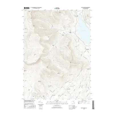
2016 Map of West Shokan
USGS Topo · Published 2016About this map
Ashokan Reservoir dominates the northeastern edge of this Catskill Mountain landscape, serving as a focal point for the surrounding topography. The terrain is defined by the high elevations of the Burroughs Range, including peaks like Friday Mtn and Balsam Cap. This high-relief environment is carved by numerous drainages such as the Bush Kill and Maltby Hollow Brook, which flow through deep valleys like Watson Hollow.
Find a feature on this map
90 named features on this map. Tap any name to fly to it.
Don’t see what you’re looking for? This feature index may not catch every label — zoom into the map to look around manually.
Map Details
Editions of this 2016 West Shokan Map
This is the sole edition of this map. No revisions or reprints were ever made.
Other maps of this area

1892 · Kaaterskill
USGS Topo · 1:62,500

1893 · Kaaterskill
USGS Topo · 1:62,500

1894 · Kaaterskill
USGS Topo · 1:62,500

1899 · Kaaterskill
USGS Topo · 1:62,500

1900 · Phoenicia
USGS Topo · 1:62,500

1901 · Rosendale
USGS Topo · 1:62,500

1903 · Rosendale
USGS Topo · 1:62,500

1903 · Phoenicia
USGS Topo · 1:62,500

1903 · Kaaterskill
USGS Topo · 1:62,500

1903 · Slide Mountain
USGS Topo · 1:62,500