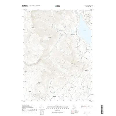
2019 Map of West Shokan
USGS Topo · Published 2019About this map
Ashokan Reservoir East Basin anchors the northeast corner of this Catskills terrain, where the hamlet of West Shokan sits at the edge of the water. The landscape is defined by steep ridges and peaks including High Point, Mombaccus Mtn, and the southern reaches of the Burroughs Range. This topographic study highlights a collection of small upland settlements and crossings that have long defined the local geography, such as Samsonville, Palentown, and Brodhead.
Find a feature on this map
88 named features on this map. Tap any name to fly to it.
Don’t see what you’re looking for? This feature index may not catch every label — zoom into the map to look around manually.
Map Details
Editions of this 2019 West Shokan Map
This is the sole edition of this map. No revisions or reprints were ever made.
Other maps of this area

1892 · Kaaterskill
USGS Topo · 1:62,500

1893 · Kaaterskill
USGS Topo · 1:62,500

1894 · Kaaterskill
USGS Topo · 1:62,500

1899 · Kaaterskill
USGS Topo · 1:62,500

1900 · Phoenicia
USGS Topo · 1:62,500

1901 · Rosendale
USGS Topo · 1:62,500

1903 · Rosendale
USGS Topo · 1:62,500

1903 · Phoenicia
USGS Topo · 1:62,500

1903 · Kaaterskill
USGS Topo · 1:62,500

1903 · Slide Mountain
USGS Topo · 1:62,500