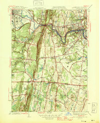
1945 Map of West Springfield
USGS Topo · Published 1945About this map
Proven Mountain and Liswell Hill rise as prominent geological landmarks between the Connecticut and Westfield River valleys during the mid-1940s. The landscape is a mix of dense industrial rail corridors, such as the Boston and Albany RR, and small agrarian hamlets including Feeding Hills and West Agawam. The era's institutional presence is notable, with the sprawling Westfield State Sanatorium and the Hampden County Training Sch occupying significant sites.
Find a feature on this map
91 named features on this map. Tap any name to fly to it.
Don’t see what you’re looking for? This feature index may not catch every label — zoom into the map to look around manually.
Map Details
Editions of this 1945 West Springfield Map
2 editions found
Other maps of this area

1886 · Springfield
USGS Topo · 1:62,500

1887 · Granville
USGS Topo · 1:62,500

1889 · Springfield
USGS Topo · 1:62,500

1889 · Granville
USGS Topo · 1:62,500

1892 · Hartford
USGS Topo · 1:62,500

1892 · Granby
USGS Topo · 1:62,500

1893 · Springfield
USGS Topo · 1:62,500

1893 · Granville
USGS Topo · 1:62,500

1895 · Springfield
USGS Topo · 1:62,500

1895 · Granville
USGS Topo · 1:62,500