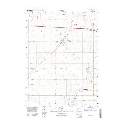
2013 Map of West Unity
USGS Topo · Published 2013About this map
The Tiffin River and its numerous tributaries, including Leatherwood Cr and Beaver Cr, define the drainage and settlement patterns of this corner of Williams County. The village of West Unity sits as a central hub at the intersection of local routes, surrounded by a landscape of productive agricultural sites such as Maneval Farms and Tiffin Meadows. To the south, the village of Stryker borders the river, while the smaller settlement of Lock Port remains situated near the Fulton County line.
Find a feature on this map
81 named features on this map. Tap any name to fly to it.
Don’t see what you’re looking for? This feature index may not catch every label — zoom into the map to look around manually.
Map Details
Editions of this 2013 West Unity Map
This is the sole edition of this map. No revisions or reprints were ever made.
Other maps of this area

1907 · Defiance
USGS Topo · 1:62,500

1909 · Defiance
USGS Topo · 1:62,500

1913 · Alvordton
USGS Topo · 1:62,500

1914 · Pioneer
USGS Topo · 1:62,500

1914 · Bryan
USGS Topo · 1:62,500

1943 · Bryan
USGS Topo · 1:62,500

1944 · Pioneer
USGS Topo · 1:62,500

1944 · Alvordton
USGS Topo · 1:62,500

1953 · Fort Wayne
USGS Topo · 1:250,000

1956 · Fort Wayne
USGS Topo · 1:250,000