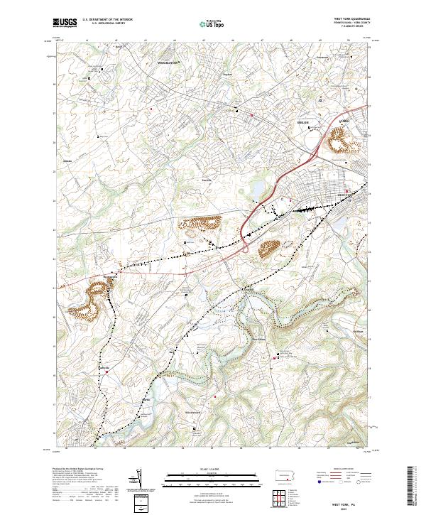
2023 Map of West York
USGS Topo · Published 2023About this map
York Valley serves as the central geographic corridor for this Pennsylvania landscape, where the urban outskirts of York and West York meet a dense network of suburban and rural communities. The map detail highlights an area where historical burial sites and modern transportation hubs exist in close proximity. Genealogists will find a wealth of information in the numerous family-named and denominational cemeteries, such as the Bair Codorus Mennonite Cem, Heindel Burial Ground, and the Hershey Burial Grounds near Martin. Transportation is a major theme, with the York Airport near Thomasville and the Gilbert Airport to the east, while the Codorus Creek winds through the southern terrain past Stoverstown. This 2023 edition documents the continued expansion of settlements like Weigelstown and Shiloh while preserving the location of local landmarks like the Consolidated School of Business.
Find a feature on this map
146 named features on this map. Tap any name to fly to it.
Don’t see what you’re looking for? This feature index may not catch every label — zoom into the map to look around manually.
Map Details
Editions of this 2023 West York Map
This is the sole edition of this map. No revisions or reprints were ever made.
Other maps of this area

1906 · New Cumberland
USGS Topo · 1:62,500

1908 · Middletown
USGS Topo · 1:62,500

1908 · York
USGS Topo · 1:62,500

1910 · York
USGS Topo · 1:62,500

1920 · Hanover
USGS Topo · 1:62,500

1922 · Hanover
USGS Topo · 1:62,500

1943 · New Cumberland
USGS Topo · 1:62,500

1943 · Middletown
USGS Topo · 1:62,500

1948 · Baltimore
USGS Topo · 1:250,000

1950 · Harrisburg
USGS Topo · 1:250,000