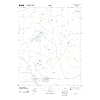
2010 Map of Westcliffe
USGS Topo · Published 2010About this map
The neighboring towns of Westcliffe and Silver Cliff anchor this 2010 survey of the Wet Mountain Valley. The landscape reveals a legacy of intense hard-rock mining, with the terrain punctuated by sites such as the Bull Domingo Mine, Lady Franklin Mine, and the Herman Passiflora Mine. These mines are concentrated around the White Hills and Silver Cliff Plateau, indicating the geological richness that drove early settlement in Custer County.
Find a feature on this map
85 named features on this map. Tap any name to fly to it.
Don’t see what you’re looking for? This feature index may not catch every label — zoom into the map to look around manually.
Map Details
Editions of this 2010 Westcliffe Map
This is the sole edition of this map. No revisions or reprints were ever made.
Other maps of this area

1889 · Canon City
USGS Topo · 1:125,000

1892 · Canon City
USGS Topo · 1:125,000

1954 · Mount Tyndall
USGS Topo · 1:24,000

1954 · Rosita
USGS Topo · 1:24,000

1954 · Pueblo
USGS Topo · 1:250,000

1955 · Westcliffe
USGS Topo · 1:24,000

1957 · Pueblo
USGS Topo · 1:250,000

1957 · Aldrich Gulch
USGS Topo · 1:24,000

1958 · Pueblo
USGS Topo · 1:250,000

1958 · Beckwith Mountain
USGS Topo · 1:24,000