
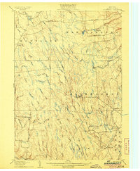
1943 Map of Westdale
USGS Topo · Published 1943About this map
Westdale stands at the confluence of the West Branch and Fish Creek, serving as a central hub for this rural stretch of Oneida County during the early 1940s. The landscape is defined by the winding course of the Mad River and the Little River, which carve through the townships of Florence and Williamstown. This era shows a community structured around a dense network of local education and faith, evidenced by numerous numbered schoolhouses like Miller School No 3 and School No 8, alongside the Union Ch.
Find a feature on this map
41 named features on this map. Tap any name to fly to it.
Don’t see what you’re looking for? This feature index may not catch every label — zoom into the map to look around manually.
Map Details
Editions of this 1943 Westdale Map
This is the sole edition of this map. No revisions or reprints were ever made.
Other maps of this area

1903 · Orwell
USGS Topo · 1:62,500

1905 · Orwell
USGS Topo · 1:62,500

1905 · Taberg
USGS Topo · 1:62,500
1906 · Highmarket
USGS Topo · 1:62,500

1906 · Kasoag
USGS Topo · 1:62,500

1942 · Redfield
USGS Topo · 1:24,000

1943 · Redfield
USGS Topo · 1:31,680
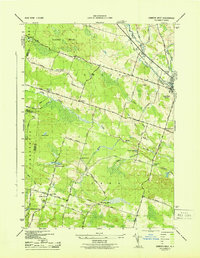
1943 · Camden West
USGS Topo · 1:31,680

1943 · East Florence
USGS Topo · 1:31,680

1943 · Camden East
USGS Topo · 1:31,680