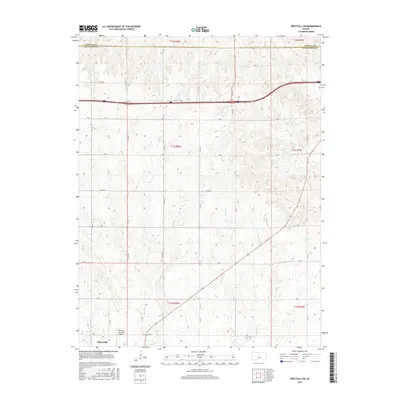
2015 Map of Westfall SW
USGS Topo · Published 2015About this map
Ellsworth sits at the southwestern edge of this Central Kansas landscape, serving as a gateway to the intricate drainage basins of the Smoky Hill River valley. The terrain is defined by a dendritic network of seasonal and perennial streams, including Oak Cr and its eastern and western branches, which carve through the undulating prairie. To the north, the headwaters of W Elkhorn Cr and E Elkhorn Cr flow toward the Lincoln County and Ellsworth County line, illustrating the natural water-driven boundaries of the region.
Find a feature on this map
33 named features on this map. Tap any name to fly to it.
Don’t see what you’re looking for? This feature index may not catch every label — zoom into the map to look around manually.
Map Details
Editions of this 2015 Westfall SW Map
This is the sole edition of this map. No revisions or reprints were ever made.
Other maps of this area

1894 · Ellsworth
USGS Topo · 1:125,000

1955 · Great Bend
USGS Topo · 1:250,000

1957 · Great Bend
USGS Topo · 1:250,000

1957 · Ellsworth
USGS Topo · 1:24,000

1957 · Westfall SW
USGS Topo · 1:24,000

1957 · Westfall SE
USGS Topo · 1:24,000
1957 · Carneiro
USGS Topo · 1:24,000

1957 · Holyrood NE
USGS Topo · 1:24,000

1957 · Black Wolf
USGS Topo · 1:24,000

1958 · Great Bend
USGS Topo · 1:250,000