
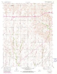
1957 Map of Westfall SW
USGS Topo · Published 1958About this map
East Elkhorn Creek and its complex network of tributaries define the high plains landscape of this mid-century survey along the Lincoln and Ellsworth County line. The terrain is marked by a series of north-south drainage patterns, including Oak Creek, Spring Creek, and Clear Creek, which carve into the rolling Kansas uplands. While much of the land is divided into large sections such as Sherman, Garfield, and Ellsworth, the map reveals the small-scale infrastructure of rural life in the 1950s. The Oak Creek Sch stands as a focal point for the surrounding farmsteads, while the Ellsworth Airport on the southern edge and a prominent Tower on a high ridge reflect the gradual modernization of this agricultural corridor. The intricate contour lines illustrate the subtle but significant elevation changes between the stream valleys and the level plateaus above.
Find a feature on this map
14 named features on this map. Tap any name to fly to it.
Don’t see what you’re looking for? This feature index may not catch every label — zoom into the map to look around manually.
Map Details
Editions of this 1957 Westfall SW Map
2 editions found
Other maps of this area

1894 · Ellsworth
USGS Topo · 1:125,000

1955 · Great Bend
USGS Topo · 1:250,000

1957 · Great Bend
USGS Topo · 1:250,000

1957 · Ellsworth
USGS Topo · 1:24,000

1957 · Westfall SE
USGS Topo · 1:24,000
1957 · Carneiro
USGS Topo · 1:24,000

1957 · Holyrood NE
USGS Topo · 1:24,000

1957 · Black Wolf
USGS Topo · 1:24,000

1958 · Great Bend
USGS Topo · 1:250,000
1963 · Westfall
USGS Topo · 1:24,000