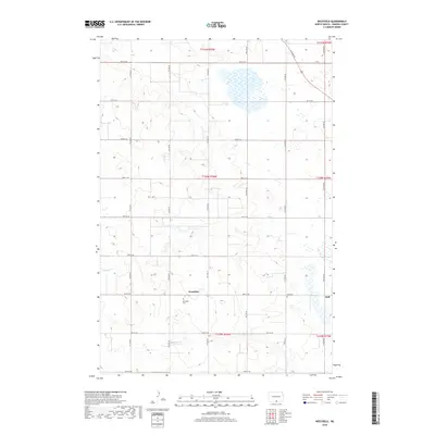
2018 Map of Westfield
USGS Topo · Published 2018About this map
Westfield and Hull serve as the primary focal points of this rural landscape in Emmons County, North Dakota. The area is defined by a rigorous grid of section lines, including 90th St SE through 98th St SE, which organize the agricultural terrain and provide access to the small local communities. This survey reveals the persistent structure of late-twentieth-century prairie life, where the local economy and social fabric are anchored by sites such as the Westfield Cem and Hull Cem. The intermittent path of Decker Cr meanders across the western sections, providing one of the few natural breaks in the otherwise geometric layout of roads and homesteads. These details reflect the traditional township system that has governed North Dakota's central plains for generations.
Find a feature on this map
26 named features on this map. Tap any name to fly to it.
Don’t see what you’re looking for? This feature index may not catch every label — zoom into the map to look around manually.
Map Details
Editions of this 2018 Westfield Map
This is the sole edition of this map. No revisions or reprints were ever made.
Other maps of this area

1953 · McIntosh
USGS Topo · 1:250,000

1954 · Bismarck
USGS Topo · 1:250,000

1958 · Bismarck
USGS Topo · 1:250,000

1958 · McIntosh
USGS Topo · 1:250,000

1965 · Herreid NW
USGS Topo · 1:24,000

1965 · Herreid NE
USGS Topo · 1:24,000

1965 · Pollock
USGS Topo · 1:24,000
1971 · Grassna
USGS Topo · 1:24,000

1971 · Grassna NE
USGS Topo · 1:24,000

1971 · Strasburg
USGS Topo · 1:24,000