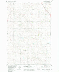
1979 Map of Westfield
USGS Topo · Published 1980About this map
Westfield serves as the primary community anchor in this late-1970s landscape of southern Emmons County. The settlement patterns of the era are visible through rural institutions like Bakker Sch and the nearby Hull Cem, while the industrial connectivity of the Great Plains is marked by the diagonal route of the Chicago Milwaukee St Paul and Pacific railroad in the northeast corner.
Find a feature on this map
10 named features on this map. Tap any name to fly to it.
Don’t see what you’re looking for? This feature index may not catch every label — zoom into the map to look around manually.
Map Details
Editions of this 1979 Westfield Map
This is the sole edition of this map. No revisions or reprints were ever made.
Other maps of this area

1953 · McIntosh
USGS Topo · 1:250,000

1954 · Bismarck
USGS Topo · 1:250,000

1958 · Bismarck
USGS Topo · 1:250,000

1958 · McIntosh
USGS Topo · 1:250,000

1965 · Herreid NW
USGS Topo · 1:24,000

1965 · Herreid NE
USGS Topo · 1:24,000

1965 · Pollock
USGS Topo · 1:24,000
1971 · Grassna
USGS Topo · 1:24,000

1971 · Grassna NE
USGS Topo · 1:24,000

1971 · Strasburg
USGS Topo · 1:24,000