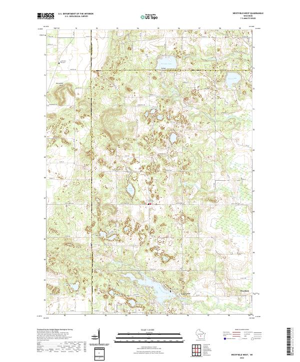
2022 Map of Westfield West
USGS Topo · Published 2022About this map
Westfield and the settlement of Lawrence anchor this central Wisconsin landscape, where the headwaters of the Fox River basin drain through glacial kettle lakes and marshy lowlands. The topography is defined by significant water bodies such as Pleasant Lake, Pine Lake, and Wood Lake, while the prominent Horseshoe Bluff rises in the northwest. This 2022 survey details the modern road network where Marquette, Adams, and Waushara counties meet, showing a transition from agricultural plots to recreational lakeside developments like Sunset Point. Local heritage is preserved in the location of rural burying grounds, including South Burr Oak Cem, Pleasant View Cem, and Riverside Cem, which sit alongside established waterways like Lawrence Creek and Caves Cr. The map illustrates a region where wetland conservation and rural residential life coexist across a complex drainage system of creeks and small lakes.
Find a feature on this map
60 named features on this map. Tap any name to fly to it.
Don’t see what you’re looking for? This feature index may not catch every label — zoom into the map to look around manually.
Map Details
Editions of this 2022 Westfield West Map
This is the sole edition of this map. No revisions or reprints were ever made.
Other maps of this area

1955 · Green Bay
USGS Topo · 1:250,000

1957 · Madison
USGS Topo · 1:250,000

1958 · Coloma
USGS Topo · 1:48,000

1959 · Wautoma
USGS Topo · 1:48,000

1960 · Madison
USGS Topo · 1:250,000

1961 · Oxford
USGS Topo · 1:62,500

1961 · Montello
USGS Topo · 1:62,500

1968 · Coloma SW
USGS Topo · 1:24,000

1968 · Coloma
USGS Topo · 1:24,000

1968 · Richford
USGS Topo · 1:24,000