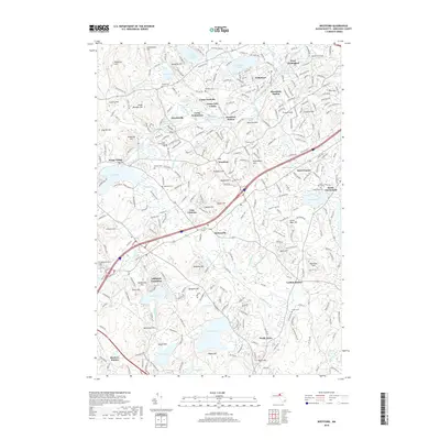
2018 Map of Westford
USGS Topo · Published 2018About this map
Graniteville and Forge Village anchor the western edge of this Middlesex County landscape, where the B & M RR line connects old industrial hamlets and station stops like Brookside Station and Carlisle Station. The terrain is defined by a dense network of hills and water bodies, including Nabnasset Pond and the expansive Nagog Pond to the south. Numerous burial grounds, such as Saint Catherines Cem and the Russian Cem, provide significant touchpoints for genealogical research across the townships of Westford, Littleton, and Chelmsford. The proximity of recreation and conservation is evident through sites like Camp Nashoba and Camp Cielo Celeste, while the presence of the Post Office in Westford center marks the civic heart of the area.
Find a feature on this map
289 named features on this map. Tap any name to fly to it.
Don’t see what you’re looking for? This feature index may not catch every label — zoom into the map to look around manually.
Map Details
Editions of this 2018 Westford Map
This is the sole edition of this map. No revisions or reprints were ever made.
Other maps of this area

1886 · Lowell
USGS Topo · 1:62,500

1886 · Framingham
USGS Topo · 1:62,500

1887 · Marlboro
USGS Topo · 1:62,500

1889 · Marlboro
USGS Topo · 1:62,500

1889 · Framingham
USGS Topo · 1:62,500

1893 · Lowell
USGS Topo · 1:62,500

1893 · Groton
USGS Topo · 1:62,500

1894 · Framingham
USGS Topo · 1:62,500

1896 · Marlboro
USGS Topo · 1:62,500

1898 · Marlboro
USGS Topo · 1:62,500