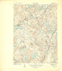
1940 Map of Westford
USGS Topo · Published 1940About this map
The mill villages of Forge Village and Graniteville anchor this 1940 survey of Middlesex County, where the industrial legacy of the late 19th century meets a landscape of glacial drumlins and kettle ponds. The Boston and Maine RR winds through the heart of Westford, serving various local stations like Westford Sta and Brookside before crossing into Chelmsford. The prominence of family-named heights such as Spalding Hill, Francis Hill, and Blakes Hill reflects long-standing agricultural and residential patterns in the area. Water bodies like the large Nagog Pond and Forge Pond are central features, likely serving as both industrial resources and growing recreational sites. For those interested in local genealogy, the map identifies specific burial grounds like Fairview Cem and Westlawn Cem, alongside vanished rural stops such as Carlisle Sta and Boxboro Sta.
Find a feature on this map
62 named features on this map. Tap any name to fly to it.
Don’t see what you’re looking for? This feature index may not catch every label — zoom into the map to look around manually.
Map Details
Editions of this 1940 Westford Map
This is the sole edition of this map. No revisions or reprints were ever made.
Other maps of this area

1886 · Lowell
USGS Topo · 1:62,500

1886 · Framingham
USGS Topo · 1:62,500

1887 · Marlboro
USGS Topo · 1:62,500

1889 · Marlboro
USGS Topo · 1:62,500

1889 · Framingham
USGS Topo · 1:62,500

1893 · Lowell
USGS Topo · 1:62,500

1893 · Groton
USGS Topo · 1:62,500

1894 · Framingham
USGS Topo · 1:62,500

1896 · Marlboro
USGS Topo · 1:62,500

1898 · Marlboro
USGS Topo · 1:62,500