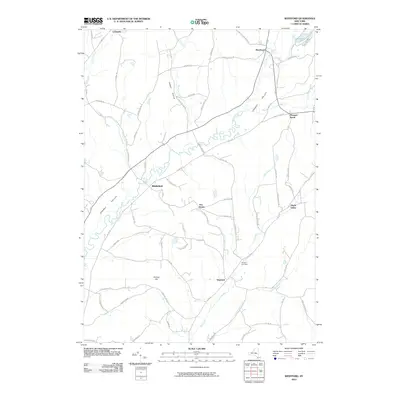
2010 Map of Westford
USGS Topo · Published 2010About this map
Cherry Valley dominates the topography of this part of Otsego County, where the meandering Cherry Valley Creek carves a path through the landscape toward Middlefield. This area of central New York is defined by its small, long-established hamlets and a dense network of country roads, many bearing family names such as Whiteman Rd and Dick Morton Rd. In the southern portion of the quadrangle, the village of Westford sits near the headwaters of Elk Creek, accompanied by the historic Westford Cemetery. The rural character of the region is evident in the scattered settlements like Five Points, Maple Valley, and Roseboom, which have served as local focal points for generations. The terrain is marked by significant elevations like Darling Hill and the tucked-away valley of Hubbel Hollow, illustrating the varied glacial geography common to the Susquehanna River watershed region.
Find a feature on this map
74 named features on this map. Tap any name to fly to it.
Don’t see what you’re looking for? This feature index may not catch every label — zoom into the map to look around manually.
Map Details
Editions of this 2010 Westford Map
This is the sole edition of this map. No revisions or reprints were ever made.
Other maps of this area

1898 · Canajoharie
USGS Topo · 1:62,500

1900 · Canajoharie
USGS Topo · 1:62,500

1902 · Canajoharie
USGS Topo · 1:62,500

1903 · Richfield Springs
USGS Topo · 1:62,500

1904 · Richmondville
USGS Topo · 1:62,500

1907 · Cooperstown
USGS Topo · 1:62,500

1909 · Cooperstown
USGS Topo · 1:62,500

1943 · Milford
USGS Topo · 1:24,000

1943 · South Valley
USGS Topo · 1:24,000

1943 · Richfield Springs
USGS Topo · 1:24,000