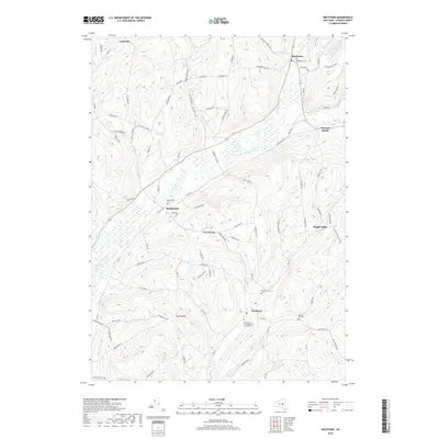
2019 Map of Westford
USGS Topo · Published 2019About this map
Cherry Valley Creek winds through the heart of this Otsego County landscape, connecting the clustered hamlets of Middlefield and Roseboom. The area is defined by a series of north-south valleys and prominent ridges like Darling Hill, where agricultural patterns and rural road networks have persisted for generations. In the eastern portion of the quadrangle, the village of Westford serves as a local hub near the headwaters of Elk Creek. This 2019 survey documents a landscape of scattered rural settlements and significant genealogical sites, including the Westford Congregational Church Cemetery and Draper Hill Cemetery. Small watercourses like O'Connell Brook and Shellrock Creek feed into the larger valley systems, illustrating the drainage patterns that shaped early settlement in these uplands. From Lentsville in the northwest to Maple Valley in the southeast, the map traces the enduring rural character of central New York.
Find a feature on this map
95 named features on this map. Tap any name to fly to it.
Don’t see what you’re looking for? This feature index may not catch every label — zoom into the map to look around manually.
Map Details
Editions of this 2019 Westford Map
This is the sole edition of this map. No revisions or reprints were ever made.
Other maps of this area

1898 · Canajoharie
USGS Topo · 1:62,500

1900 · Canajoharie
USGS Topo · 1:62,500

1902 · Canajoharie
USGS Topo · 1:62,500

1903 · Richfield Springs
USGS Topo · 1:62,500

1904 · Richmondville
USGS Topo · 1:62,500

1907 · Cooperstown
USGS Topo · 1:62,500

1909 · Cooperstown
USGS Topo · 1:62,500

1943 · Milford
USGS Topo · 1:24,000

1943 · South Valley
USGS Topo · 1:24,000

1943 · Richfield Springs
USGS Topo · 1:24,000