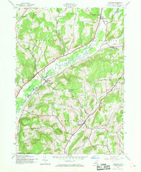
1943 Map of Westford
USGS Topo · Published 1969About this map
Westford and the surrounding townships of Middlefield and Roseboom define this agrarian landscape during the early 1940s. The region is characterized by small, dispersed hamlets such as Maple Valley and Lentsville, connected by a network of winding valley roads. Agricultural and local civic life are evidenced by the survival of several numbered rural schoolhouses, including School No 10 and School No 7, which served these upland communities before the widespread consolidation of the postwar era.
Find a feature on this map
29 named features on this map. Tap any name to fly to it.
Don’t see what you’re looking for? This feature index may not catch every label — zoom into the map to look around manually.
Map Details
Editions of this 1943 Westford Map
3 editions found

Other maps of this area

1898 · Canajoharie
USGS Topo · 1:62,500

1900 · Canajoharie
USGS Topo · 1:62,500

1902 · Canajoharie
USGS Topo · 1:62,500

1903 · Richfield Springs
USGS Topo · 1:62,500

1904 · Richmondville
USGS Topo · 1:62,500

1907 · Cooperstown
USGS Topo · 1:62,500

1909 · Cooperstown
USGS Topo · 1:62,500

1943 · Milford
USGS Topo · 1:24,000

1943 · South Valley
USGS Topo · 1:24,000

1943 · Richfield Springs
USGS Topo · 1:24,000