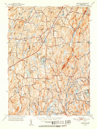
1952 Map of Westford
USGS Topo · Published 1953About this map
Union and Westford anchor this portrait of north-central Connecticut, where the rugged topography of the Nipmuck State Forest dictates the flow of human settlement. The landscape is defined by its ridge-and-valley structure, with prominent elevations like Walker Mtn and Bald Hill rising above a dense network of watercourses, including the Fenton River and Mount Hope River. These streams were vital to early local industry, as evidenced by names like Lead Mine Brook and the vicinity of Lead Mine Hill.
Find a feature on this map
82 named features on this map. Tap any name to fly to it.
Don’t see what you’re looking for? This feature index may not catch every label — zoom into the map to look around manually.
Map Details
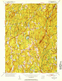
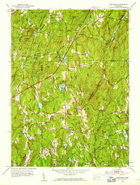
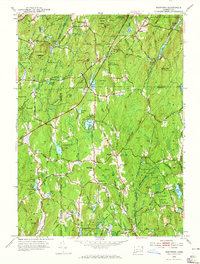
Editions of this 1952 Westford Map
5 editions found

Other maps of this area

1887 · Brookfield
USGS Topo · 1:62,500

1887 · Palmer
USGS Topo · 1:62,500

1889 · Palmer
USGS Topo · 1:62,500

1890 · Brookfield
USGS Topo · 1:62,500

1892 · Woodstock
USGS Topo · 1:62,500

1892 · Tolland
USGS Topo · 1:62,500

1893 · Palmer
USGS Topo · 1:62,500

1893 · Brookfield
USGS Topo · 1:62,500

1908 · Ware
USGS Topo · 1:125,000

1915 · Brookfield
USGS Topo · 1:62,500