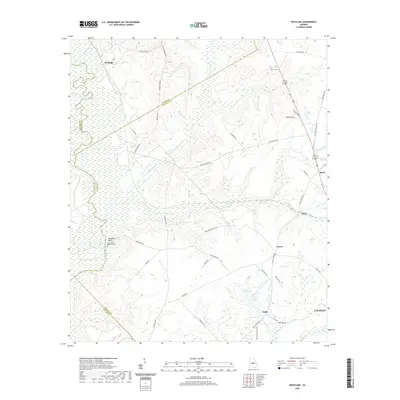
2020 Map of Westlake
USGS Topo · Published 2020About this map
The Ocmulgee River defines the western edge of this landscape, carving a wide floodplain against Stephens Bluff where the James Dykes Memorial Park is situated. This region of central Georgia is characterized by a dense network of minor waterways, including the winding Shellstone Creek and its southern branch, which feed into the primary river valley. The map reveals a transition from these low-lying wetlands and bottomlands to a series of rural clusters and named family locations like Paulk and Coley.
Find a feature on this map
52 named features on this map. Tap any name to fly to it.
Don’t see what you’re looking for? This feature index may not catch every label — zoom into the map to look around manually.
Map Details
Editions of this 2020 Westlake Map
This is the sole edition of this map. No revisions or reprints were ever made.
Other maps of this area

1956 · Cochran
USGS Topo · 1:62,500

1956 · Perry
USGS Topo · 1:62,500

1956 · Warner Robins
USGS Topo · 1:62,500

1956 · Jeffersonville
USGS Topo · 1:62,500

1957 · Macon
USGS Topo · 1:250,000

1958 · Macon
USGS Topo · 1:250,000

1964 · Macon
USGS Topo · 1:250,000

1973 · Hayneville
USGS Topo · 1:24,000

1973 · Klondike
USGS Topo · 1:24,000

1973 · Tarversville
USGS Topo · 1:24,000