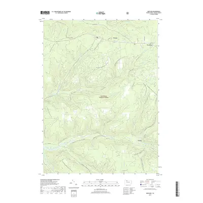
2019 Map of Westline
USGS Topo · Published 2019About this map
Allegheny National Forest dominates this landscape in McKean County, defined by a dense network of drainages such as Kinzua Creek and Chappel Fork. Small settlements are concentrated along the northern and eastern peripheries, including Klondike, Marshburg, and Westline. The presence of the Marshburg Cem near the junction of Forresty Rd and Klondike Rd provides a fixed point for local genealogical interest.
Find a feature on this map
51 named features on this map. Tap any name to fly to it.
Don’t see what you’re looking for? This feature index may not catch every label — zoom into the map to look around manually.
Map Details
Editions of this 2019 Westline Map
This is the sole edition of this map. No revisions or reprints were ever made.
Other maps of this area

1924 · Bradford
USGS Topo · 1:62,500

1926 · Bradford
USGS Topo · 1:62,500

1934 · Kane
USGS Topo · 1:48,000

1935 · Mt. Jewett
USGS Topo · 1:48,000

1936 · Kinzua
USGS Topo · 1:48,000

1939 · Kane
USGS Topo · 1:62,500

1940 · Mt. Jewett
USGS Topo · 1:62,500

1941 · Kinzua
USGS Topo · 1:62,500

1941 · Bradford
USGS Topo · 1:62,500

1944 · Bradford
USGS Topo · 1:62,500
Featured Places
- Lafayette Township, PA
- Westline, Lafayette Township
- Corydon Township, PA
- Wetmore Township, PA
- Hamilton Township, PA