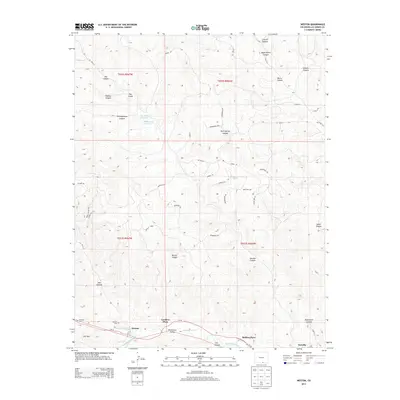
2013 Map of Weston
USGS Topo · Published 2013About this map
The Purgatoire River carves a central lifeline through this Las Animas County landscape, sustaining a string of Hispanic settlements along the river corridor. The community of Weston serves as a primary hub, situated near the confluence where the S Fork Purgatoire River joins the main branch. Local history is deeply etched into the riverbank at Cordova Plaza, Medina Plaza, and the small settlement of Sarcillo. Genealogists may find value in the location of Weston Cem and Pacheca Cem, which mark the generational presence of families in this valley. North of the river, the terrain rises into a complex network of drainages including Lincoln Canyon and Burro Canyon. Higher elevations feature water management via the Ojo Verde Reservoir and McDonald Reservoir, while distinctive landforms like The Island and the Ute Hills overlook the Picketwire Valley floor.
Find a feature on this map
58 named features on this map. Tap any name to fly to it.
Don’t see what you’re looking for? This feature index may not catch every label — zoom into the map to look around manually.
Map Details
Editions of this 2013 Weston Map
This is the sole edition of this map. No revisions or reprints were ever made.
Other maps of this area

1891 · Spanish Peaks
USGS Topo · 1:125,000

1893 · Spanish Peaks
USGS Topo · 1:125,000

1895 · Spanish Peaks
USGS Topo · 1:125,000

1897 · Spanish Peaks
USGS Topo · 1:125,000

1900 · Spanish Peaks
USGS Topo · 1:125,000

1951 · Valdez
USGS Topo · 1:24,000

1951 · Madrid
USGS Topo · 1:24,000

1954 · Trinidad
USGS Topo · 1:250,000

1955 · Trinidad
USGS Topo · 1:250,000

1958 · Trinidad
USGS Topo · 1:250,000