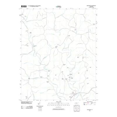
2010 Map of Westpoint
USGS Topo · Published 2010About this map
Factory Creek and Chisholm Creek carve a complex system of hollows and ridges across this Lawrence County landscape, where the local economy was once heavily tied to mining and timber. The map document's numerous iron ore extraction sites, including the Hessemer Number One Mine, Hessemer Number Two Mine, and Ironsides Mine, suggest a period of intensive industrial activity in the Tennessee hills. These operations are situated near family-named landmarks like Shakerag Ridge and Boarding House Hill, the latter likely serving the workers of the nearby Pinkney Mine.
Find a feature on this map
98 named features on this map. Tap any name to fly to it.
Don’t see what you’re looking for? This feature index may not catch every label — zoom into the map to look around manually.
Map Details
Editions of this 2010 Westpoint Map
This is the sole edition of this map. No revisions or reprints were ever made.
Other maps of this area

1905 · Waynesboro
USGS Topo · 1:125,000

1936 · Westpoint
USGS Topo · 1:24,000

1936 · Deerfield
USGS Topo · 1:24,000

1936 · Collinwood
USGS Topo · 1:24,000

1936 · Light
USGS Topo · 1:24,000

1936 · Negro Hollow
USGS Topo · 1:24,000

1936 · Long Branch
USGS Topo · 1:24,000

1936 · Loretto
USGS Topo · 1:24,000
1936 · St. Joseph
USGS Topo · 1:24,000

1936 · Ovilla
USGS Topo · 1:24,000