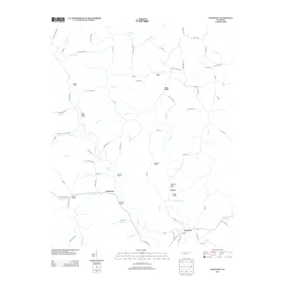
2013 Map of Westpoint
USGS Topo · Published 2013About this map
The community of Westpoint serves as a focal point in this southern Tennessee landscape, where the waters of Chisholm Cr and Factory Cr converge. The topography is defined by a dense network of ridges and hollows, often carrying family names that reflect the local heritage, such as Sims Ridge, Melton Hollow, and John McGee Hollow. Notable elevations like Shakerag Ridge and Boarding House Hill rise above the drainage basins, while the presence of Pouring Spring, Dishongh Spring, and Greenhall Spring indicates the importance of natural water sources to the area's rural development.
Find a feature on this map
92 named features on this map. Tap any name to fly to it.
Don’t see what you’re looking for? This feature index may not catch every label — zoom into the map to look around manually.
Map Details
Editions of this 2013 Westpoint Map
This is the sole edition of this map. No revisions or reprints were ever made.
Other maps of this area

1905 · Waynesboro
USGS Topo · 1:125,000

1936 · Westpoint
USGS Topo · 1:24,000

1936 · Deerfield
USGS Topo · 1:24,000

1936 · Collinwood
USGS Topo · 1:24,000

1936 · Light
USGS Topo · 1:24,000

1936 · Negro Hollow
USGS Topo · 1:24,000

1936 · Long Branch
USGS Topo · 1:24,000

1936 · Loretto
USGS Topo · 1:24,000
1936 · St. Joseph
USGS Topo · 1:24,000

1936 · Ovilla
USGS Topo · 1:24,000