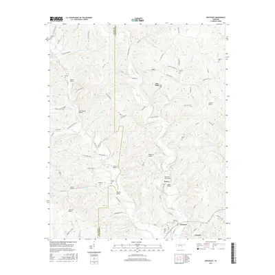
2016 Map of Westpoint
USGS Topo · Published 2016About this map
Westpoint sits at the convergence of several drainages in Lawrence County, including Factory Creek and Chisholm Creek, serving as a focal point for the surrounding hollows and ridges. This 2016 survey illustrates a landscape defined by its many named hollows—such as Happy Hollow, Melton Hollow, and John McGee Hollow—which reflect generations of family residency and local geography. The mapping of the Wayne Co Lawrence Co boundary running north-to-south provides a clear view of the political divisions cutting through this creek-veined territory.
Find a feature on this map
98 named features on this map. Tap any name to fly to it.
Don’t see what you’re looking for? This feature index may not catch every label — zoom into the map to look around manually.
Map Details
Editions of this 2016 Westpoint Map
This is the sole edition of this map. No revisions or reprints were ever made.
Other maps of this area

1905 · Waynesboro
USGS Topo · 1:125,000

1936 · Westpoint
USGS Topo · 1:24,000

1936 · Deerfield
USGS Topo · 1:24,000

1936 · Collinwood
USGS Topo · 1:24,000

1936 · Light
USGS Topo · 1:24,000

1936 · Negro Hollow
USGS Topo · 1:24,000

1936 · Long Branch
USGS Topo · 1:24,000

1936 · Loretto
USGS Topo · 1:24,000
1936 · St. Joseph
USGS Topo · 1:24,000

1936 · Ovilla
USGS Topo · 1:24,000