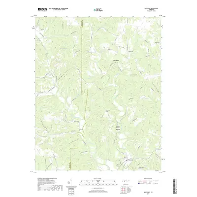
2019 Map of Westpoint
USGS Topo · Published 2019About this map
Westpoint sits at the confluence of several vital waterways in southern Tennessee, where Factory Creek meets Chisholm Creek near the rail line. This 2019 survey documents a landscape defined by deep hollows and prominent ridges, such as Shakerag Ridge and Sims Ridge, which have historically dictated the placement of mountain roads and small settlements. The area around Pinkney and Lodi reveals a high density of small family and community burial grounds, including the Old West Point Cem, Wisdom Cem, and Bethlehem Cem, providing essential geographic markers for genealogists. The presence of Boarding House Hill suggests a history of localized industry or travel hubs, while naming conventions for features like John McGee Hollow and Nelson Hollow preserve the legacy of early resident families across the Wayne and Lawrence County line.
Find a feature on this map
99 named features on this map. Tap any name to fly to it.
Don’t see what you’re looking for? This feature index may not catch every label — zoom into the map to look around manually.
Map Details
Editions of this 2019 Westpoint Map
This is the sole edition of this map. No revisions or reprints were ever made.
Other maps of this area

1905 · Waynesboro
USGS Topo · 1:125,000

1936 · Westpoint
USGS Topo · 1:24,000

1936 · Deerfield
USGS Topo · 1:24,000

1936 · Collinwood
USGS Topo · 1:24,000

1936 · Light
USGS Topo · 1:24,000

1936 · Negro Hollow
USGS Topo · 1:24,000

1936 · Long Branch
USGS Topo · 1:24,000

1936 · Loretto
USGS Topo · 1:24,000
1936 · St. Joseph
USGS Topo · 1:24,000

1936 · Ovilla
USGS Topo · 1:24,000