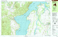
1999 Map of Westport
USGS Topo · Published 2000About this map
Lake Champlain dominates this late-century landscape, where the waters of North West Bay meet the steep eastern slopes of the Adirondack Mountains. The shoreline is characterized by a series of deep inlets and rocky points, including Snake Den Harbor and Basin Harbor, which have long supported seasonal recreation at sites like Camp Dudley and Camp Normandie. On the New York shore, the village of Westport serves as a local hub, featuring the Westport Central Sch and St Philips Neri Ch.
Find a feature on this map
100 named features on this map. Tap any name to fly to it.
Don’t see what you’re looking for? This feature index may not catch every label — zoom into the map to look around manually.
Map Details
Editions of this 1999 Westport Map
This is the sole edition of this map. No revisions or reprints were ever made.
Other maps of this area

1894 · Elizabethtown
USGS Topo · 1:62,500

1894 · Port Henry
USGS Topo · 1:62,500

1895 · Willsboro
USGS Topo · 1:62,500

1895 · Elizabethtown
USGS Topo · 1:62,500

1895 · Ausable
USGS Topo · 1:62,500

1898 · Port Henry
USGS Topo · 1:62,500

1901 · Elizabethtown
USGS Topo · 1:62,500

1903 · Ausable
USGS Topo · 1:62,500

1903 · Middlebury
USGS Topo · 1:62,500

1905 · Middlebury
USGS Topo · 1:62,500