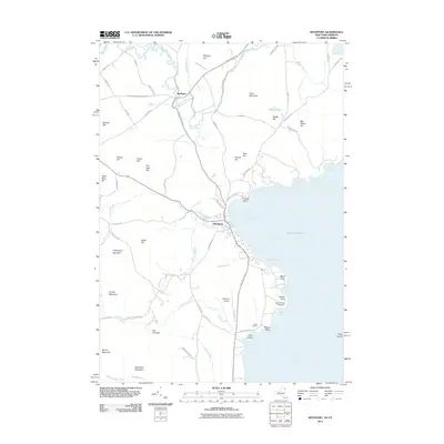
2012 Map of Westport
USGS Topo · Published 2012About this map
Westport sits prominently along the shore of North West Bay in this 2012 survey, serving as a hub for the shoreline communities of Lake Champlain. The town is characterized by its lakeside orientation, featuring the Westport Airport and the historic Barbers Point Lighthouse further south on Barber Point. Inland, the settlement of Wadhams is situated where State Hwy 22 Scen crosses the Boquet River, an area marked by a series of winding river bends and local roads like Elizabethtown-Wadhams Rd. The landscape is defined by significant elevations and family-named landmarks including Hoisington Mountain, Coon Mountain, and The Pinnacle. To the south, Camp Dudley occupies the lakefront near Moore Point and Cole Island, reflecting the long-standing recreational and educational heritage of this section of the Adirondack Park.
Find a feature on this map
77 named features on this map. Tap any name to fly to it.
Don’t see what you’re looking for? This feature index may not catch every label — zoom into the map to look around manually.
Map Details
Editions of this 2012 Westport Map
This is the sole edition of this map. No revisions or reprints were ever made.
Other maps of this area

1894 · Elizabethtown
USGS Topo · 1:62,500

1894 · Port Henry
USGS Topo · 1:62,500

1895 · Willsboro
USGS Topo · 1:62,500

1895 · Elizabethtown
USGS Topo · 1:62,500

1895 · Ausable
USGS Topo · 1:62,500

1898 · Port Henry
USGS Topo · 1:62,500

1901 · Elizabethtown
USGS Topo · 1:62,500

1903 · Ausable
USGS Topo · 1:62,500

1941 · Willsboro
USGS Topo · 1:62,500

1943 · Willsboro
USGS Topo · 1:62,500