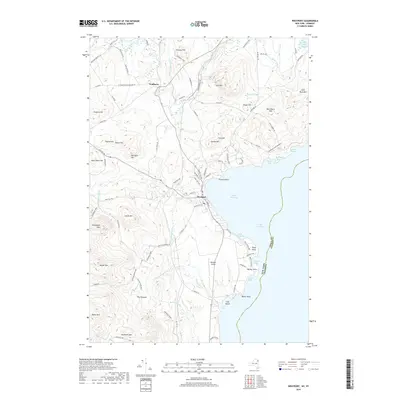
2019 Map of Westport
USGS Topo · Published 2019About this map
Westport sits prominently along the western shores of Lake Champlain, serving as a central point of settlement where the lakefront meets the rising slopes of the eastern Adirondacks. To the north, the town of Wadhams is situated near the Boquet River, which winds through the northern portion of the quadrangle. The shoreline is marked by distinct geographical features such as Furnace Point, Cold Spring Bay, and Barber Point, reflecting a landscape defined by its maritime orientation.
Find a feature on this map
96 named features on this map. Tap any name to fly to it.
Don’t see what you’re looking for? This feature index may not catch every label — zoom into the map to look around manually.
Map Details
Editions of this 2019 Westport Map
This is the sole edition of this map. No revisions or reprints were ever made.
Other maps of this area

1894 · Elizabethtown
USGS Topo · 1:62,500

1894 · Port Henry
USGS Topo · 1:62,500

1895 · Willsboro
USGS Topo · 1:62,500

1895 · Elizabethtown
USGS Topo · 1:62,500

1895 · Ausable
USGS Topo · 1:62,500

1898 · Port Henry
USGS Topo · 1:62,500

1901 · Elizabethtown
USGS Topo · 1:62,500

1903 · Ausable
USGS Topo · 1:62,500

1941 · Willsboro
USGS Topo · 1:62,500

1943 · Willsboro
USGS Topo · 1:62,500