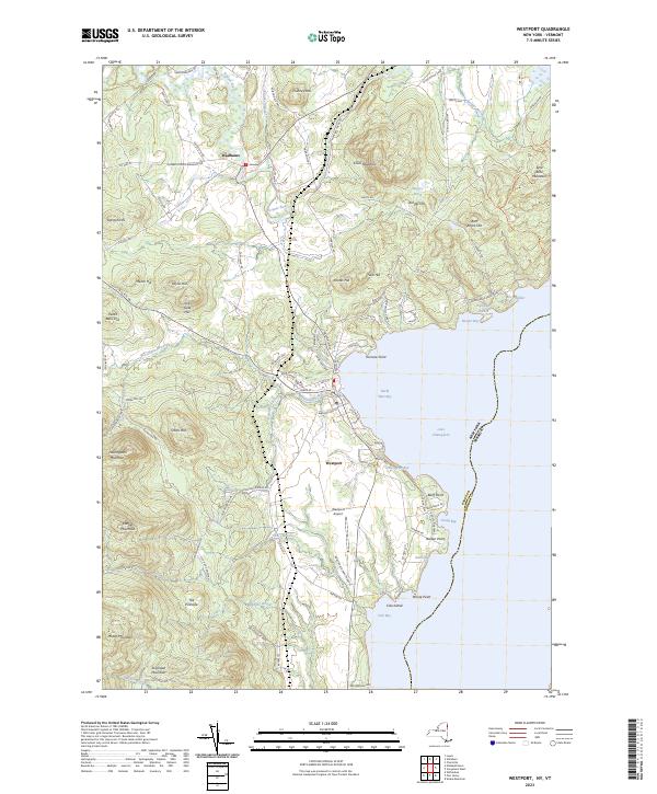
2023 Map of Westport
USGS Topo · Published 2023About this map
Westport sits prominently on the western shore of Lake Champlain, serving as a focal point for this section of the Adirondack coast. The terrain is defined by a series of significant heights, including Coon Mountain and Split Rock Mountain, which rise sharply from the water. In the interior, the Boquet River winds through the landscape past Wadhams, illustrating the transition from the rugged lakefront to the agricultural and wooded uplands within the Adirondack Park boundary.
Find a feature on this map
101 named features on this map. Tap any name to fly to it.
Don’t see what you’re looking for? This feature index may not catch every label — zoom into the map to look around manually.
Map Details
Editions of this 2023 Westport Map
This is the sole edition of this map. No revisions or reprints were ever made.
Other maps of this area

1894 · Elizabethtown
USGS Topo · 1:62,500

1894 · Port Henry
USGS Topo · 1:62,500

1895 · Willsboro
USGS Topo · 1:62,500

1895 · Elizabethtown
USGS Topo · 1:62,500

1895 · Ausable
USGS Topo · 1:62,500

1898 · Port Henry
USGS Topo · 1:62,500

1901 · Elizabethtown
USGS Topo · 1:62,500

1903 · Ausable
USGS Topo · 1:62,500

1941 · Willsboro
USGS Topo · 1:62,500

1943 · Willsboro
USGS Topo · 1:62,500