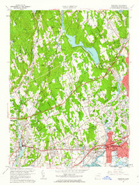
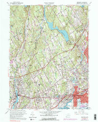
1960 Map of Westport
USGS Topo · Published 1962About this map
Coastal development and mid-century suburban expansion define this landscape during a period of significant growth along Long Island Sound. The map documents the intricate transportation corridor of the Connecticut Turnpike, Merritt Parkway, and the New York New Haven and Hartford Railroad as they weave through Fairfield, Westport, and Southport. Beyond the bustling town centers of Mill Plain and Lyons Plain, the interior is characterized by a series of massive water projects, including the Hemlock Reservoir, Aspetuck Reservoir, and Saugatuck Reservoir, which reshaped the local topography.
Find a feature on this map
74 named features on this map. Tap any name to fly to it.
Don’t see what you’re looking for? This feature index may not catch every label — zoom into the map to look around manually.
Map Details
Editions of this 1960 Westport Map
5 editions found
Other maps of this area

1889 · Derby
USGS Topo · 1:62,500

1891 · Bridgeport
USGS Topo · 1:62,500

1891 · Derby
USGS Topo · 1:62,500

1892 · Danbury
USGS Topo · 1:62,500

1892 · Norwalk
USGS Topo · 1:62,500

1893 · Bridgeport
USGS Topo · 1:62,500

1893 · Norwalk
USGS Topo · 1:62,500

1893 · Derby
USGS Topo · 1:62,500

1915 · Danbury
USGS Topo · 1:62,500

1920 · Bridgeport
USGS Topo · 1:62,500