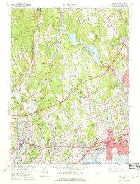
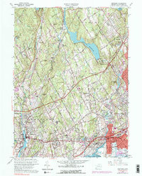
1960 Map of Westport
USGS Topo · Published 1969About this map
Westport and Fairfield are shown during a period of significant mid-century suburban expansion, defined by the winding paths of the Merritt Parkway and the Connecticut Turnpike. The landscape is a mix of established coastal settlements and inland residential growth, with the New York New Haven and Hartford Railroad providing the vital transit link through Southport. Educational and religious institutions are prominent, including the campus of Fairfield University and several local schools like Staples High School and Ludlowe High School.
Find a feature on this map
93 named features on this map. Tap any name to fly to it.
Don’t see what you’re looking for? This feature index may not catch every label — zoom into the map to look around manually.
Map Details
Editions of this 1960 Westport Map
5 editions found
Other maps of this area

1889 · Derby
USGS Topo · 1:62,500

1891 · Bridgeport
USGS Topo · 1:62,500

1891 · Derby
USGS Topo · 1:62,500

1892 · Danbury
USGS Topo · 1:62,500

1892 · Norwalk
USGS Topo · 1:62,500

1893 · Bridgeport
USGS Topo · 1:62,500

1893 · Norwalk
USGS Topo · 1:62,500

1893 · Derby
USGS Topo · 1:62,500

1915 · Danbury
USGS Topo · 1:62,500

1920 · Bridgeport
USGS Topo · 1:62,500