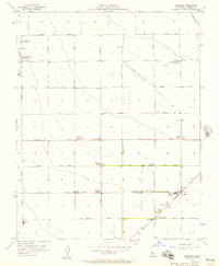
1956 Map of Westside
USGS Topo · Published 1957About this map
Large-scale agricultural operations and early industrial infrastructure define this mid-1950s landscape in Fresno County. Named properties such as Vista del Llano Farms and Airway Farms sit alongside family holdings including the Harnish Ranch, Matheson Ranch, and O'Neill Ranch. The survey captures a moment of transition where mechanized farming meets the petroleum industry, evidenced by the presence of a Cotton Gin and Grain Tanks near Oil Sumps and the Towne Oil Station (Abandoned).
Find a feature on this map
30 named features on this map. Tap any name to fly to it.
Don’t see what you’re looking for? This feature index may not catch every label — zoom into the map to look around manually.
Map Details
Editions of this 1956 Westside Map
2 editions found
Other maps of this area

1912 · Coalinga
USGS Topo · 1:125,000

1923 · Englebrecht Ranch
USGS Topo · 1:31,680

1925 · Helm
USGS Topo · 1:31,680

1925 · San Joaquin
USGS Topo · 1:31,680

1928 · Delta Farms No 3
USGS Topo · 1:31,680

1931 · Wheatville
USGS Topo · 1:31,680

1931 · Towne Oil Station
USGS Topo · 1:31,680

1931 · Mouth of Cantua Creek
USGS Topo · 1:31,680

1932 · Delta Farms
USGS Topo · 1:31,680

1932 · West of Lethent
USGS Topo · 1:31,680