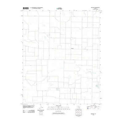
2010 Map of Westway
USGS Topo · Published 2010About this map
Westway anchors this portion of Deaf Smith County, situated within a strictly organized grid of agricultural roads in the Texas Panhandle. The landscape is defined by the ephemeral path of Tierra Blanca Creek, which winds through the southern half of the quadrangle, breaking the rigid geometry of the county road system. This 2010 survey illustrates the deep reliance on regional transit, with Fm 1058 and Fm 1057 serving as primary connectors between the small settlement and the surrounding plains. The naming convention of the local routes, such as Co Rd Mm and Co Rd Kk, reflects the systematic land partitioning characteristic of this high plains region, where vast stretches of territory are mapped with alphabetic and numeric precision.
Find a feature on this map
18 named features on this map. Tap any name to fly to it.
Don’t see what you’re looking for? This feature index may not catch every label — zoom into the map to look around manually.
Map Details
Editions of this 2010 Westway Map
This is the sole edition of this map. No revisions or reprints were ever made.
Other maps of this area

1954 · Clovis
USGS Topo · 1:250,000

1958 · Clovis
USGS Topo · 1:250,000

1966 · Friona
USGS Topo · 1:24,000

1966 · Easter
USGS Topo · 1:24,000

1966 · Summerfield
USGS Topo · 1:24,000

1970 · Chalk Hill
USGS Topo · 1:24,000

1970 · Hereford
USGS Topo · 1:24,000

1971 · Westway
USGS Topo · 1:24,000
1971 · Milo Center
USGS Topo · 1:24,000
1971 · Westway NW
USGS Topo · 1:24,000