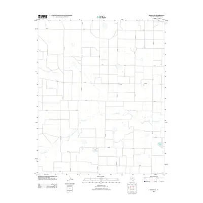
2012 Map of Westway
USGS Topo · Published 2012About this map
Tierra Blanca Cr winds through this High Plains landscape, cutting a natural path across the structured agricultural grid of Deaf Smith County. The settlement of Westway sits at the intersection of this drainage and Fm-1058, serving as a central point for the surrounding farm-to-market road network. This 2012 survey documents the precise layout of rural routes like Co Rd MM and 9th Rd, reflecting the large-scale land divisions characteristic of the Texas Panhandle. The map reveals the relationship between water resources and transportation, showing how local thoroughfares such as Fm-1057 and Co Rd KK navigate the playa-dotted terrain of this intensive agricultural region.
Find a feature on this map
23 named features on this map. Tap any name to fly to it.
Don’t see what you’re looking for? This feature index may not catch every label — zoom into the map to look around manually.
Map Details
Editions of this 2012 Westway Map
This is the sole edition of this map. No revisions or reprints were ever made.
Other maps of this area

1954 · Clovis
USGS Topo · 1:250,000

1958 · Clovis
USGS Topo · 1:250,000

1966 · Friona
USGS Topo · 1:24,000

1966 · Easter
USGS Topo · 1:24,000

1966 · Summerfield
USGS Topo · 1:24,000

1970 · Chalk Hill
USGS Topo · 1:24,000

1970 · Hereford
USGS Topo · 1:24,000

1971 · Westway
USGS Topo · 1:24,000
1971 · Milo Center
USGS Topo · 1:24,000
1971 · Westway NW
USGS Topo · 1:24,000