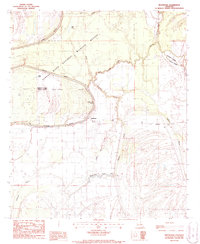
1987 Map of Westwood
USGS Topo · Published 1987About this map
The Tensas River meanders across this alluvial landscape, shaping a complex network of oxbow lakes and drainages within the Tensas River National Wildlife Refuge. The map details the transition from bottomland forest and wetlands to the rural settlements of Westwood and Dearborn. Evidence of long-term human presence is visible in the Indian Mounds located near the banks of DuRosset Bayou and Shackleford Lake, while a lonely Cem label denotes a local burial site. The hydrological character of the Madison and Tensas Parish boundary is defined by a maze of waterways, including Mack Bayou, Mill Bayou, and Spring Bayou. These labels document the intricate drainage patterns of the Louisiana Delta during the late 1980s, serving as a record for those studying the natural geography and small-scale habitation of this riverine environment.
Find a feature on this map
19 named features on this map. Tap any name to fly to it.
Don’t see what you’re looking for? This feature index may not catch every label — zoom into the map to look around manually.
Map Details
Editions of this 1987 Westwood Map
This is the sole edition of this map. No revisions or reprints were ever made.
Other maps of this area

1935 · Waverly
USGS Topo · 1:62,500

1935 · Shackleford Lake
USGS Topo · 1:62,500

1939 · Talla Bena
USGS Topo · 1:62,500

1955 · Jackson
USGS Topo · 1:250,000

1958 · Shackleford Lake
USGS Topo · 1:62,500

1961 · Jackson
USGS Topo · 1:250,000

1961 · Waverly
USGS Topo · 1:62,500

1962 · Jackson
USGS Topo · 1:250,000
1963 · Somerset
USGS Topo · 1:24,000
1963 · Fortune Fork
USGS Topo · 1:24,000