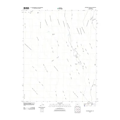
2010 Map of Wetherill Mesa
USGS Topo · Published 2010About this map
Ancient architectural sites and resource extraction marks define this portion of the Verde Mesa plateau. The landscape is characterized by a dense network of canyons, including Rock Canyon and Long Canyon, where numerous ancestral dwellings are situated. Significant named structures such as Long House, Mug House, and Step House are clustered along the cliffs of Wetherill Mesa, accessible via the namesake Wetherill Mesa Rd. Near the North Rim, evidence of industry appears at the Mesa Verde Mine and Jackson Mine, showing the intersection of prehistoric heritage and later mineral interests.
Find a feature on this map
58 named features on this map. Tap any name to fly to it.
Don’t see what you’re looking for? This feature index may not catch every label — zoom into the map to look around manually.
Map Details
Editions of this 2010 Wetherill Mesa Map
This is the sole edition of this map. No revisions or reprints were ever made.
Other maps of this area

1912 · Soda Canyon
USGS Topo · 1:62,500

1915 · Soda Canyon
USGS Topo · 1:62,500

1956 · Cortez
USGS Topo · 1:250,000

1958 · Cortez SW
USGS Topo · 1:24,000

1958 · Cortez
USGS Topo · 1:250,000

1959 · Cortez
USGS Topo · 1:250,000

1962 · Cortez
USGS Topo · 1:250,000

1965 · Cortez
USGS Topo · 1:24,000
1965 · Point Lookout
USGS Topo · 1:24,000

1966 · Cortez
USGS Topo · 1:250,000