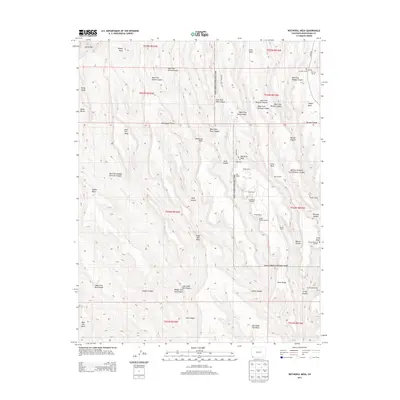
2013 Map of Wetherill Mesa
USGS Topo · Published 2013About this map
Mesa Verde National Park protects a complex landscape of deep canyons and prominent mesas in Montezuma County. The dramatic topography of Wetherill Mesa and Chapin Mesa is defined by sheer drops into the East Fork Rock Canyon and Navajo Canyon. The density of named dwellings throughout the area reveals a deeply layered human history, with sites like Long House, Mug House, and Step House built into the cliffs and mesa tops.
Find a feature on this map
62 named features on this map. Tap any name to fly to it.
Don’t see what you’re looking for? This feature index may not catch every label — zoom into the map to look around manually.
Map Details
Editions of this 2013 Wetherill Mesa Map
This is the sole edition of this map. No revisions or reprints were ever made.
Other maps of this area

1912 · Soda Canyon
USGS Topo · 1:62,500

1915 · Soda Canyon
USGS Topo · 1:62,500

1956 · Cortez
USGS Topo · 1:250,000

1958 · Cortez SW
USGS Topo · 1:24,000

1958 · Cortez
USGS Topo · 1:250,000

1959 · Cortez
USGS Topo · 1:250,000

1962 · Cortez
USGS Topo · 1:250,000

1965 · Cortez
USGS Topo · 1:24,000
1965 · Point Lookout
USGS Topo · 1:24,000

1966 · Cortez
USGS Topo · 1:250,000