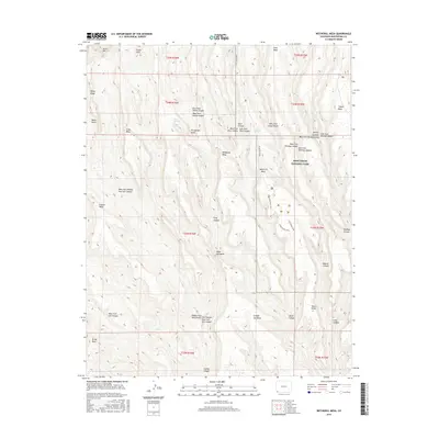
2016 Map of Wetherill Mesa
USGS Topo · Published 2016About this map
Mesa Verde National Park anchors this terrain in Montezuma County, defined by the stark parallel fingers of high tablelands and the deep canyons that separate them. The map highlights Wetherill Mesa and Chapin Mesa, which stand as significant landforms containing the archaeological heritage of the region. A network of complex drainage systems, such as Navajo Canyon, Rock Canyon, and Wickiup Canyon, creates a deeply dissected landscape where water sources like Horse Springs and Rock Springs were historically critical.
Find a feature on this map
45 named features on this map. Tap any name to fly to it.
Don’t see what you’re looking for? This feature index may not catch every label — zoom into the map to look around manually.
Map Details
Editions of this 2016 Wetherill Mesa Map
This is the sole edition of this map. No revisions or reprints were ever made.
Other maps of this area

1912 · Soda Canyon
USGS Topo · 1:62,500

1915 · Soda Canyon
USGS Topo · 1:62,500

1956 · Cortez
USGS Topo · 1:250,000

1958 · Cortez SW
USGS Topo · 1:24,000

1958 · Cortez
USGS Topo · 1:250,000

1959 · Cortez
USGS Topo · 1:250,000

1962 · Cortez
USGS Topo · 1:250,000

1965 · Cortez
USGS Topo · 1:24,000
1965 · Point Lookout
USGS Topo · 1:24,000

1966 · Cortez
USGS Topo · 1:250,000