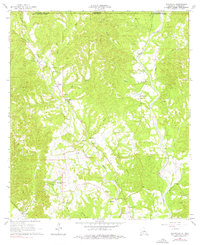
1965 Map of Weyanoke
USGS Topo · Published 1976About this map
Feliciana Plantation Plettenberg PO and Ellerslie Plantation anchor this mid-1960s survey of the borderlands between Louisiana and Mississippi. The landscape is defined by the winding course of Little Bayou Sara and Bayou Sara, which flow through a region marked by rural community centers and family landholdings. Clusters of historic significance appear at Weyanoke and Plettenberg, where an Old Railroad Grade hints at former transportation corridors. Numerous small churches, including Magnolia Ch and St Pauls Ch, serve as local landmarks alongside various gravel pits that indicate the area's geological activity. From the Mississippi state line down to Highland Plantation, the map details a quiet agricultural and wooded territory where the names of small branches and creeks, such as Judas Branch and Lucy Creek, record long-standing local geography.
Find a feature on this map
43 named features on this map. Tap any name to fly to it.
Don’t see what you’re looking for? This feature index may not catch every label — zoom into the map to look around manually.
Map Details
Editions of this 1965 Weyanoke Map
2 editions found
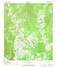
Other maps of this area

1906 · Bayou Sara
USGS Topo · 1:125,000

1936 · Woodville
USGS Topo · 1:62,500

1939 · St. Francisville
USGS Topo · 1:62,500

1939 · Artonish
USGS Topo · 1:62,500

1941 · Batchelor
USGS Topo · 1:62,500

1953 · Natchez
USGS Topo · 1:250,000

1954 · Elm Park
USGS Topo · 1:24,000

1954 · Artonish
USGS Topo · 1:62,500

1954 · Baton Rouge
USGS Topo · 1:250,000

1955 · Artonish
USGS Topo · 1:62,500