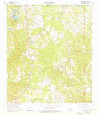
1965 Map of Laurel Hill
USGS Topo · Published 1976About this map
Woodlawn Plantation and Laurel Hill Plantation anchor the landscape of West Feliciana Parish during this mid-1960s survey, illustrating the historical land-use patterns of the Louisiana-Mississippi borderlands. The corridor of the Illinois Central railroad runs north-south through Laurel Hill and Wakefield, serving as a primary transit artery alongside numerous gravel pits that hint at local extractive industry.
Find a feature on this map
42 named features on this map. Tap any name to fly to it.
Don’t see what you’re looking for? This feature index may not catch every label — zoom into the map to look around manually.
Map Details
Editions of this 1965 Laurel Hill Map
2 editions found
Other maps of this area

1906 · Bayou Sara
USGS Topo · 1:125,000

1936 · Woodville
USGS Topo · 1:62,500

1939 · St. Francisville
USGS Topo · 1:62,500

1941 · Lost Creek
USGS Topo · 1:31,680

1945 · Jackson
USGS Topo · 1:31,680

1945 · Lost Creek
USGS Topo · 1:31,680

1953 · Natchez
USGS Topo · 1:250,000

1954 · Elm Park
USGS Topo · 1:24,000
1954 · Jackson
USGS Topo · 1:24,000

1954 · Baton Rouge
USGS Topo · 1:250,000