
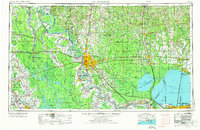
1954 Map of Baton Rouge
USGS Topo · Published 1974About this map
The Mississippi River winds through the heart of south-central Louisiana in this mid-century survey, anchoring a landscape defined by its complex relationship with water. To the west, the Atchafalaya Floodway and Morganza Floodway illustrate the massive engineering efforts required to manage the basin's drainage. The map reveals the dense rail networks of the era, including the Illinois Central Gulf RR and Southern Pacific RR, which connected river towns like Donaldsonville and Plaquemine to larger hubs like Baton Rouge and New Orleans.
Find a feature on this map
257 named features on this map. Tap any name to fly to it.
Don’t see what you’re looking for? This feature index may not catch every label — zoom into the map to look around manually.
Map Details
Editions of this 1954 Baton Rouge Map
2 editions found
Other maps of this area

1891 · Hahnville
USGS Topo · 1:62,500

1891 · Spanish Fort
USGS Topo · 1:62,500

1891 · New Orleans
USGS Topo · 1:62,500

1892 · Lac Des Allemands
USGS Topo · 1:62,500

1892 · Chef Menteur
USGS Topo · 1:62,500

1892 · Mount Airy
USGS Topo · 1:62,500

1892 · Bonnet Carre
USGS Topo · 1:62,500

1892 · Donaldsonville
USGS Topo · 1:62,500

1892 · St. Bernard
USGS Topo · 1:62,500

1892 · Thibodaux
USGS Topo · 1:62,500