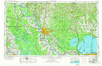
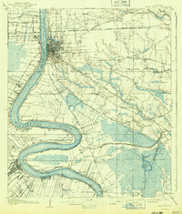
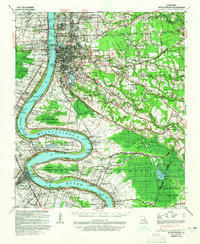
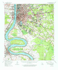
1954 Map of Baton Rouge
USGS Topo · Published 1974About this map
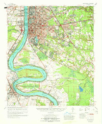
The Mississippi River serves as the dominant spine for this mid-century look at South Louisiana, connecting the industrial growth of Baton Rouge to the outer reaches of New Orleans. Extensive civil engineering efforts are visible through the massive Atchafalaya Floodway, Morganza Floodway, and Bonnet Carre Floodway, which define the region's relationship with its waterways. To the west, the landscape transitions into the bayous of Lafayette and Saint Martinville, where the Longfellow-Evangeline State Park stands near the banks of Bayou Teche.
Find a feature on this map
80 named features on this map. Tap any name to fly to it.
Don’t see what you’re looking for? This feature index may not catch every label — zoom into the map to look around manually.
Map Details
Editions of this 1954 Baton Rouge Map
2 editions found

Historical Maps of New Orleans Through Time
9 maps found
1908 Baton Rouge
East Baton Rouge Parish, LA
1939 Baton Rouge
East Baton Rouge Parish, LA
1954 Baton Rouge
East Baton Rouge Parish, LA

1956 Baton Rouge
East Baton Rouge Parish, LA

1961 Baton Rouge
East Baton Rouge Parish, LA

1962 Baton Rouge
East Baton Rouge Parish, LA
1963 Baton Rouge
East Baton Rouge Parish, LA
1965 Baton Rouge
East Baton Rouge Parish, LA

1984 Baton Rouge
East Baton Rouge Parish, LA