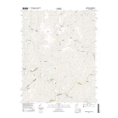
2014 Map of Wharncliffe
USGS Topo · Published 2014About this map
Wharncliffe and Glen Alum anchor this rugged landscape where the borders of West Virginia, Kentucky, and Virginia converge along the Tug Fork river valley. The terrain is defined by deep hollows and narrow ridges, such as Ben Creek Mtn and Glen Alum Mtn, housing a constellation of small mining and railroad settlements including War Eagle, Mohawk, and Isaban.
Find a feature on this map
92 named features on this map. Tap any name to fly to it.
Don’t see what you’re looking for? This feature index may not catch every label — zoom into the map to look around manually.
Map Details
Editions of this 2014 Wharncliffe Map
This is the sole edition of this map. No revisions or reprints were ever made.
Other maps of this area

1886 · Grundy
USGS Topo · 1:125,000

1887 · Warfield
USGS Topo · 1:125,000

1890 · Grundy
USGS Topo · 1:125,000

1891 · Tazewell
USGS Topo · 1:125,000

1891 · Oceana
USGS Topo · 1:125,000

1891 · Warfield
USGS Topo · 1:125,000

1892 · Grundy
USGS Topo · 1:125,000

1893 · Oceana
USGS Topo · 1:125,000

1895 · Tazewell
USGS Topo · 1:125,000

1897 · Tazewell
USGS Topo · 1:125,000