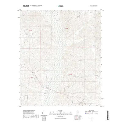
2020 Map of Whatley
USGS Topo · Published 2020About this map
The settlement of Whatley lies at the heart of this Clarke County landscape, where the confluence of Bassett Cr and Fishers Cr shapes the local topography. This 2020 record highlights the rural character of the region, featuring several family and community landmarks such as Davis Cem and Whatley Cem. The terrain is defined by a series of narrow watercourses, including Pole Bridge Branch and Pigeon Cr, which weave between the wooded uplands of the t8n r4e and t9n r4e townships.
Find a feature on this map
56 named features on this map. Tap any name to fly to it.
Don’t see what you’re looking for? This feature index may not catch every label — zoom into the map to look around manually.
Map Details
Editions of this 2020 Whatley Map
This is the sole edition of this map. No revisions or reprints were ever made.
Other maps of this area

1953 · Andalusia
USGS Topo · 1:250,000

1957 · Andalusia
USGS Topo · 1:250,000

1972 · Whatley
USGS Topo · 1:24,000

1972 · Claiborne
USGS Topo · 1:24,000

1972 · Suggsville
USGS Topo · 1:24,000

1972 · Chance
USGS Topo · 1:24,000

1973 · Fulton East
USGS Topo · 1:24,000

1973 · Lower Peach Tree
USGS Topo · 1:24,000
1978 · Grove Hill
USGS Topo · 1:24,000
1978 · Fulton West
USGS Topo · 1:24,000