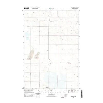
2014 Map of Wheat Basin
USGS Topo · Published 2014About this map
Wheat Basin serves as the central hub of this Montana landscape, where the flat expanses of the Lake Basin give way to the more defined elevations of Rattlesnake Ridge in the south. The area is defined by a series of intermittent water bodies and drainages, most notably Halfbreed Lake and the northern reaches of Big Lake, which are connected by the seasonal flows of Cedar Cr and Lost Cr. The rural infrastructure is built around a grid of local thoroughfares such as Molt-Rapelje Rd and Wheat Basin Rd, reflecting a landscape dedicated to large-scale agriculture and ranching. The presence of named tracks like Battle Butte Rd and Hageman Rd suggests a history of localized land use and family holdings typical of Stillwater County’s dryland farming regions. This survey provides a clear view of the intersection between natural topographical basins and the human-ordered township and range system.
Find a feature on this map
20 named features on this map. Tap any name to fly to it.
Don’t see what you’re looking for? This feature index may not catch every label — zoom into the map to look around manually.
Map Details
Editions of this 2014 Wheat Basin Map
This is the sole edition of this map. No revisions or reprints were ever made.
Other maps of this area

1889 · Big Snowy Mountain
USGS Topo · 1:250,000

1892 · Stillwater
USGS Topo · 1:125,000

1893 · Big Snowy Mountain
USGS Topo · 1:250,000

1954 · Billings
USGS Topo · 1:250,000

1954 · Roundup
USGS Topo · 1:250,000

1956 · Hunter Lake
USGS Topo · 1:24,000

1956 · Battle Butte
USGS Topo · 1:24,000

1956 · Molt
USGS Topo · 1:24,000

1956 · Wheat Basin
USGS Topo · 1:24,000

1956 · Rock Spring
USGS Topo · 1:24,000