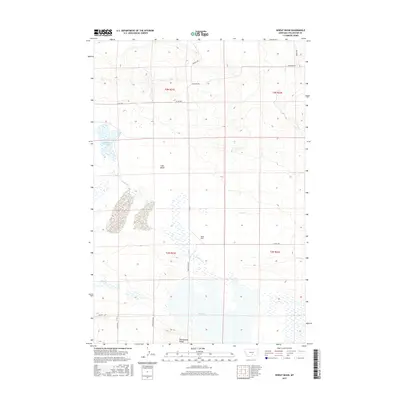
2017 Map of Wheat Basin
USGS Topo · Published 2017About this map
Halfbreed Lake and the expansive Big Lake define this high-plains landscape in Stillwater County, where seasonal water and drainage patterns shape the terrain. The area is characterized by significant natural depressions, most notably Lake Basin and Wheat Basin, which serve as focal points for the local geography. These basins are bounded by rising land such as Rattlesnake Ridge to the south, creating a complex hydrologic network of intermittent flows including Cedar Creek and Lost Cr.
Find a feature on this map
19 named features on this map. Tap any name to fly to it.
Don’t see what you’re looking for? This feature index may not catch every label — zoom into the map to look around manually.
Map Details
Editions of this 2017 Wheat Basin Map
This is the sole edition of this map. No revisions or reprints were ever made.
Other maps of this area

1889 · Big Snowy Mountain
USGS Topo · 1:250,000

1892 · Stillwater
USGS Topo · 1:125,000

1893 · Big Snowy Mountain
USGS Topo · 1:250,000

1954 · Billings
USGS Topo · 1:250,000

1954 · Roundup
USGS Topo · 1:250,000

1956 · Hunter Lake
USGS Topo · 1:24,000

1956 · Battle Butte
USGS Topo · 1:24,000

1956 · Molt
USGS Topo · 1:24,000

1956 · Wheat Basin
USGS Topo · 1:24,000

1956 · Rock Spring
USGS Topo · 1:24,000