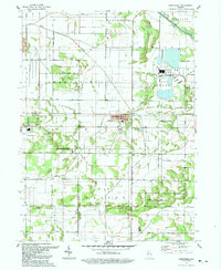
1992 Map of Wheatfield
USGS Topo · Published 1992About this map
Wheatfield serves as the primary hub in this corner of Jasper County, characterized by a grid of agricultural drainage ditches and early infrastructure. The landscape is defined by its industrial and environmental markers, from the large Powerplant and Substation complex near the Kankakee River to the protected Stoutsburg Savanna State Nature Preserve. The map reveals the critical role of water management in the region, with an extensive network including James Ditch, Delehanty Ditch, and Davis Ditch facilitating the cultivation of the surrounding plains.
Find a feature on this map
36 named features on this map. Tap any name to fly to it.
Don’t see what you’re looking for? This feature index may not catch every label — zoom into the map to look around manually.
Map Details
Editions of this 1992 Wheatfield Map
This is the sole edition of this map. No revisions or reprints were ever made.
Other maps of this area

1953 · Hebron
USGS Topo · 1:24,000

1953 · Kouts
USGS Topo · 1:24,000

1953 · Chicago
USGS Topo · 1:250,000

1957 · Chicago
USGS Topo · 1:250,000

1957 · Wheatfield
USGS Topo · 1:24,000

1957 · DeMotte
USGS Topo · 1:24,000

1958 · La Crosse
USGS Topo · 1:24,000

1959 · San Pierre
USGS Topo · 1:24,000

1962 · Medaryville
USGS Topo · 1:24,000

1962 · Gifford
USGS Topo · 1:24,000